


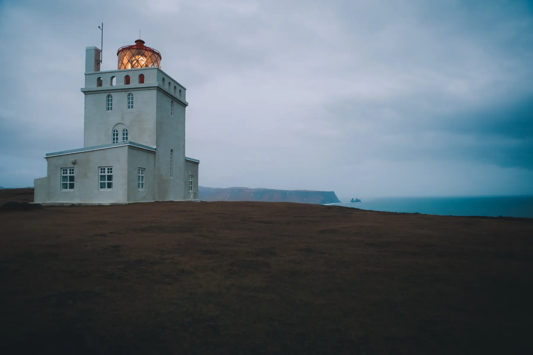
Choose a viewpoint outing, not a beach shortcut
Dyrhólaey is best planned as its own coastal stop. Choose the views you want, check which areas are accessible, and leave time to return to your vehicle. You do not need to combine every viewpoint with a beach visit to make the detour worthwhile.
The headland rises about 120 metres above the coast near Vík. Its rock arch, lighthouse and sea views give it a different character from the waterfalls farther west. Visit South Iceland describes an exposed, often windy cliff setting and warns visitors away from the edge. [2]
Our map marks the destination area from official tourism coordinates. It is an orientation point, not a parking entrance, a walking route or a recommendation to approach a cliff at that exact spot.
Dyrhólaey near Vík
On the map
Explore the locations using the links below.
OpenFreeMap · © OpenMapTiles · © OpenStreetMap
Destination area marker only. Follow current signs for permitted paths and parking; this point does not identify a safe cliff position.
Location sources
Lower Lágey or upper Háey?
Road 218 leaves Route 1 and branches within Dyrhólaey towards Lágey and Háey. The Nature Conservation Agency lists parking and toilets at Lágey, with fewer parking spaces at Háey and a warning that the upper road can be hazardous in winter. [1]
| Area | Visitor focus | Planning choice |
|---|---|---|
| Lágey | Lower headland and marked viewpoints | Start with a contained outing rather than assuming you must continue uphill |
| Háey | Upper headland and lighthouse | Add only when the approach and conditions suit your vehicle and group |
The agency describes marked paths within the reserve, including a connection between the two areas. A connected path does not make both areas a compulsory circuit. Check the signs before deciding how far to walk. [1]
Its current visitor page says one service fee covers both parking areas. Follow the site’s payment instructions and official tariff for your vehicle rather than an old blog price. Lágey’s toilets are listed as open throughout the year; temporary service interruptions remain possible. [1] [5]
Before leaving the car, agree on a turning point and a return time. Include the walk back, putting away camera equipment and changing wet clothing in your plan. If the upper approach is unsuitable, do not improvise parking or walk along a road simply to reach the lighthouse.
Cliffs are not beach access
Kirkjufjara, below the headland, is closed to visitors. The official management account links the closure to rockfalls and coastal accidents. It also explains that the path between Lágey and Háey was moved inland because sections of cliff edge had cracked and could collapse without much warning. [3]
Stay within the marked visitor areas. A worn patch beyond a fence is not a viewpoint endorsement, and a calm sea does not remove a cliff stability problem. Do not climb down to the sand, cross a barrier or move closer to the edge to fit the arch into a photograph.
Reynisfjara is a separate destination, not the continuation of this walk. If you also plan to go there, read Safetravel’s beach notice independently. It warns about sudden waves and falling rock, with access controlled by current conditions and local instructions. Never use a quiet interval between waves as a reason to approach the water. [6]
Your season changes the decision
Spring and summer
Nesting protection can limit visiting hours. The agency’s notice dated 28 April 2026 closed Dyrhólaey from 19:00 until 09:00 during 1 May to 25 June 2026. That period has ended. It is evidence of how seasonal restrictions work, not an opening timetable for your next visit or for 2027. Check the notice for your own dates. [4]
Bring binoculars if birds are your priority, and watch from permitted paths without approaching burrows. Treat a sighting as a possibility, not an appointment. A wildlife photograph on a summer travel page does not promise the same scene in autumn.
Autumn and winter
Build the outing around daylight and a forecast you have actually read. The lighthouse photograph on this page was taken in January, but a historical image is not evidence that a road or path will be suitable today. If the wind makes comfortable movement difficult, keep the stop optional rather than trying to complete the plan at all costs.
Read the official weather forecast and warnings and check Umferðin before setting out. Neither an old route description nor a general regional forecast replaces signs at the reserve. Our Travel conditions page provides dated snapshots and official links, not a real time emergency service. [7] [8]
Fit Dyrhólaey around Vík
For a local day, make one coastal outing the main outdoor choice and keep time for the village. The Vík guide covers town stops and alternatives without assuming every nearby attraction belongs in the same afternoon.
If you have a glacier activity arranged, work backwards from its confirmed meeting time and location. Our Sólheimajökull guide explains the separate decisions involved there. A flexible viewpoint stop is easier to shorten than a booked activity, so do not put the two on equally rigid schedules.
Continuing east after an overnight stay? Use the Vík to Höfn two day plan for the next section. Avoid adding Dyrhólaey to a long onward day merely because it looks close on the map. The useful question is what you would remove to give it enough attention.
Common questions
Do I have to visit both areas?
No. Choose an outing that fits the available daylight, your group and current access. The map is not a checklist.
Can I go down to Kirkjufjara?
No. The official management guidance records the beach closure. View the coast only from permitted areas and respect barriers.
Are the 2026 nesting hours valid for my next trip?
Do not assume so. The dated spring notice applied to a defined period. Look for the current announcement before planning an early or late visit.
Is this a guide to entering the lighthouse?
No. The lighthouse is a landscape landmark in this guide; no interior admission or opening hours have been verified.
Sources & useful links
Checked 16 October 2026. Trail access, weather and operator details can change.
- Nature Conservation Agency: Dyrhólaey access, paths and services ↗
- Visit South Iceland: Dyrhólaey landscape and location ↗
- Environment Agency: Dyrhólaey access and cliff management ↗
- Nature Conservation Agency: dated 2026 nesting restriction ↗
- Nature Conservation Agency: current tariff information ↗
- Safetravel: Reynisfjara beach safety and current access ↗
- Icelandic Meteorological Office: forecasts and warnings ↗
- Icelandic Road and Coastal Administration: road information ↗