

Start with the visit you want
Þingvellir National Park brings together a rift landscape and the historic meeting place of Iceland’s Alþing. The assembly began here around 930 and continued meeting at Þingvellir until 1798. Its World Heritage status reflects that cultural history, not just the view. [1]
For a first visit, our suggested starting point is Hakið, beside the visitor centre at P1. You can look across the landscape before deciding how far to walk. The centre is next to the viewing platform and the descent into Almannagjá. [2]
Choose your parking destination before setting off from Reykjavík. Navigating to the name of the national park alone leaves the actual starting point undecided. If your main interest is the waterfall or church, another car park may fit better.
Þingvellir National Park
On the map
Explore the locations using the links below.
Hakið is the visitor area above Almannagjá. Follow the park signs for parking and paths.
Location sources
Which car park should you use?
| Car park | Location | Useful starting point for |
|---|---|---|
| P1 Hakið | At the upper end of Almannagjá | Visitor centre, viewpoint and gorge |
| P2 Efri Vellir | East of and below Öxarárfoss | A visit centred on the waterfall |
| P5 Valhöll | Nearest to the church and Silfra | The lower assembly area |
On 28 September 2026, the park lists parking at 1,000 ISK for a passenger car with five or fewer seats. Other vehicle categories have different rates. One payment covers P1, P2 and P5 for the day of payment. It is a calendar day allowance, not a rolling 24 hours. [3]
Pay at machines at the visitor centre, neighbouring restroom building, P2 or P5, or online through Checkit. Check the official parking instructions before paying.
A disabled parking permit grants exemption, but you must have your registration removed from the camera system through the visitor centre or by email. [3]
A practical first walk
Use this as a sequence of places to consider, with the park’s assembly site map and the signs on the ground. It is not a fixed circuit or a statement that every connecting path is open today. The park describes the assembly site trails as well signed. [4]
- Begin at Hakið. Look across the plain from the viewpoint. Locate the river and church before heading down into the gorge.
- Walk into Almannagjá. Follow the designated path from the visitor centre area. If you leave your car at P1, include the return uphill when deciding how far to continue. [2]
- Make time for Lögberg. Read the interpretation around the historic assembly site. The park’s brochure explains the Law Rock’s role in the recitation of laws. [5]
- Decide whether to add Öxarárfoss. The waterfall and the lower assembly grounds offer different extensions. Consult the map, your remaining daylight and any closures before choosing. You do not need to connect every landmark to have a worthwhile visit. [4]
- Return to your chosen car park. Save its name or location on your phone. Do not assume that reaching another parking area means you have completed the walk back.
If steps, gradients or longer walking distances are a concern, ask visitor centre staff about a suitable route for the conditions that day. A nearby parking area is not a guarantee of an accessible path. Describe what your group needs before committing to the descent.
What are you looking at?
The cracks and cliffs belong to a wider zone of tectonic movement. The park explains that Þingvellir lies on the plate boundary system of the Atlantic ridge, with faults revealing the stretching of the crust. Almannagjá is one visible feature in that landscape. [6]
Look beyond the rock walls, too. The assembly grounds contain remains of turf and stone booths used by people attending the Alþing. Much of the interest lies in understanding what once happened on ground that can now look open and quiet. Reading the interpretation adds meaning to the walk. [1]
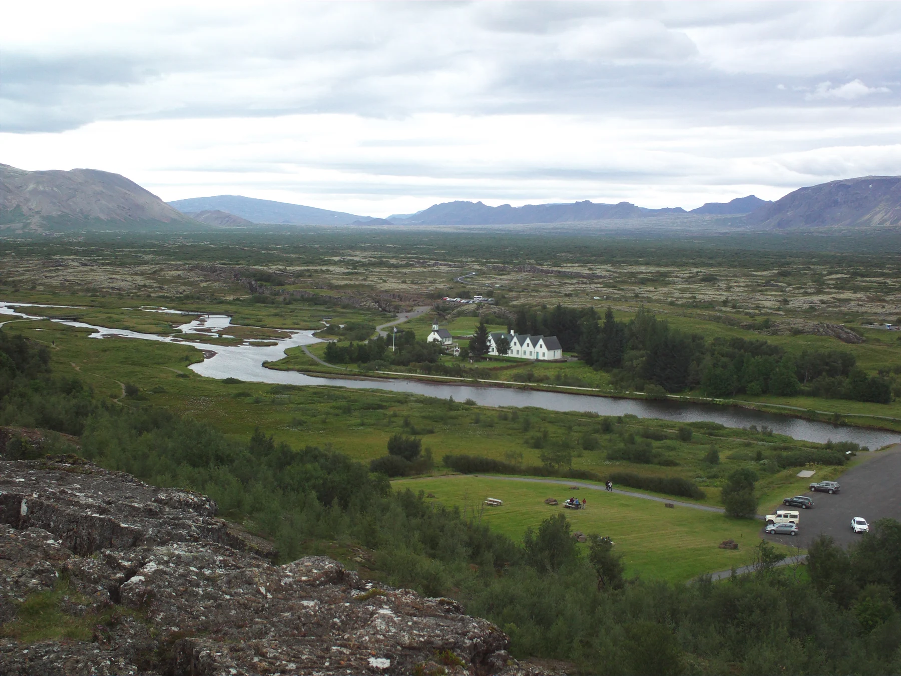
The photograph above shows the church and neighbouring buildings from the viewing platform in 2014. Use it to recognise the setting, not to judge current parking arrangements, path access or weather.
Allow time for the place
Our planning suggestion is to reserve about two to three hours for an unhurried first visit with walking and stops to read. This is an editorial allowance, not an official route duration. Add time if you want the exhibition, a longer walk or a slow photography stop.
The Heart of Iceland exhibition is inside the Hakið visitor centre and has a separate admission charge. The centre’s current page lists opening hours of 09:00 to 18:00 from April through October and 09:00 to 17:00 from November through March, with different arrangements around Christmas and New Year. Confirm the current hours and exhibition prices before relying on an indoor stop. [2]
For a day with several destinations, choose one main walk and leave the rest flexible. If you are also considering a natural hot spring, count its approach, changing time and any entry arrangements separately. A full itinerary is not improved by treating every stop as a quick photograph.
Let conditions shape the walk
Check Travel conditions before leaving, then use the linked official road and weather services for your route. Safetravel notes that weather and road conditions can change quickly. A clear morning in Reykjavík does not replace checking the journey ahead. [7]
Carry a warm layer and weather protection, and choose footwear for the actual ground surface. In cold weather, ask about ice before setting out; shorten your plans if you cannot walk comfortably. Keep enough daylight for the return rather than using every available minute at the furthest stop.
The park’s visitor brochure warns of rock cracks and fissures. Stay on designated paths, respect barriers and avoid shortcuts across the landscape. Protect vegetation and historic features, take litter away and park only in designated areas. [5]
Questions before you go
Is Thingvellir the same place as Þingvellir?
Yes. Thingvellir is the spelling commonly used when the Icelandic letter Þ is unavailable. Both names refer to the same national park.
Do I need to pay again if I move from P1 to P5?
No, the current fee covers all three listed car parks on the payment date.
Can I see something without doing a long walk?
The Hakið viewing platform is beside the visitor centre. Start there, then decide whether the descent and return suit your group. Ask staff about current access if mobility is a concern.
Should I follow a fixed walking loop?
Use the official map and current signs to choose a route. Keeping the walk flexible makes it easier to respond to weather, surface conditions and the time available.
Sources & useful links
Checked 28 September 2026. Trail access, weather and operator details can change.
- UNESCO: Þingvellir World Heritage site ↗
- Þingvellir National Park: visitor centre ↗
- Þingvellir National Park: parking service ↗
- Þingvellir National Park: hiking trails and maps ↗
- Þingvellir National Park: visitor brochure and park rules ↗
- Þingvellir National Park: nature and geology ↗
- Safetravel: conditions and travel advice ↗