


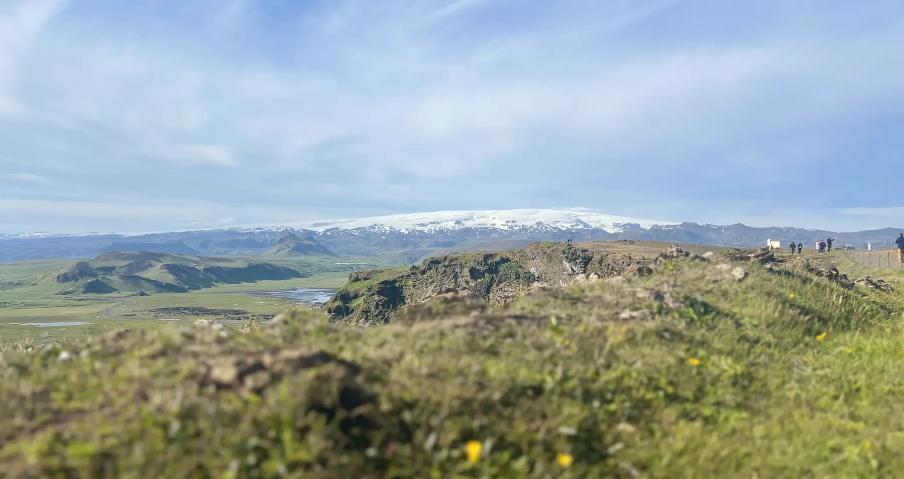
Which part of Katla is visible?
Look at the pale skyline in the photograph. The white surface is Mýrdalsjökull, the ice cap. Katla is the volcano beneath it. Even on a perfectly clear day you are looking at the roof of ice, not into a crater. Katla Geopark is a third name you will see on maps: it describes a much wider landscape, not a single place to drive to. [1]
Vík and Mýrdalur
On the map
Explore the locations using the links below.
OpenFreeMap · © OpenMapTiles · © OpenStreetMap
Headland and village area markers only. Neither point is a route onto the ice.
Location sources
Google Maps displays all locations as stops. Their order is not a suggested itinerary.
Turn inland at Dyrhólaey
If the headland is already on your itinerary, take a moment to turn away from the sea arch. In clear weather the contrast is easiest to pick out where the dark foothills meet the broad white ice. Use a permitted viewing area and stay back from the cliff edge. Moving closer to the edge will not clear cloud from the mountain. [2]
Before taking Road 218, check our Dyrhólaey viewpoint guide for the distinction between the lower headland and the lighthouse area. Follow posted restrictions. If the ice is hidden, enjoy the coast for its own sake or continue to town.
See the ash up close in Vík
For a sense of what lies under that white surface, look for Brydebúð at Víkurbraut 28 in Vík. The Katla Visitor Centre has volcanic material you can touch. Try comparing the grain of the ash with the other mineral samples, then look for the exhibition on eruptions and glacial floods. This is a different way to understand Katla when the ice cap is out of sight. [1] [3]
Check opening arrangements with the centre before making a special trip. If you are choosing between the exhibition and a longer stop in town, see our Vík village guide. Neither map marker below is a route to the crater or an entry point onto the ice.
Sources & useful links
Checked 10 November 2026. Trail access, weather and operator details can change.