


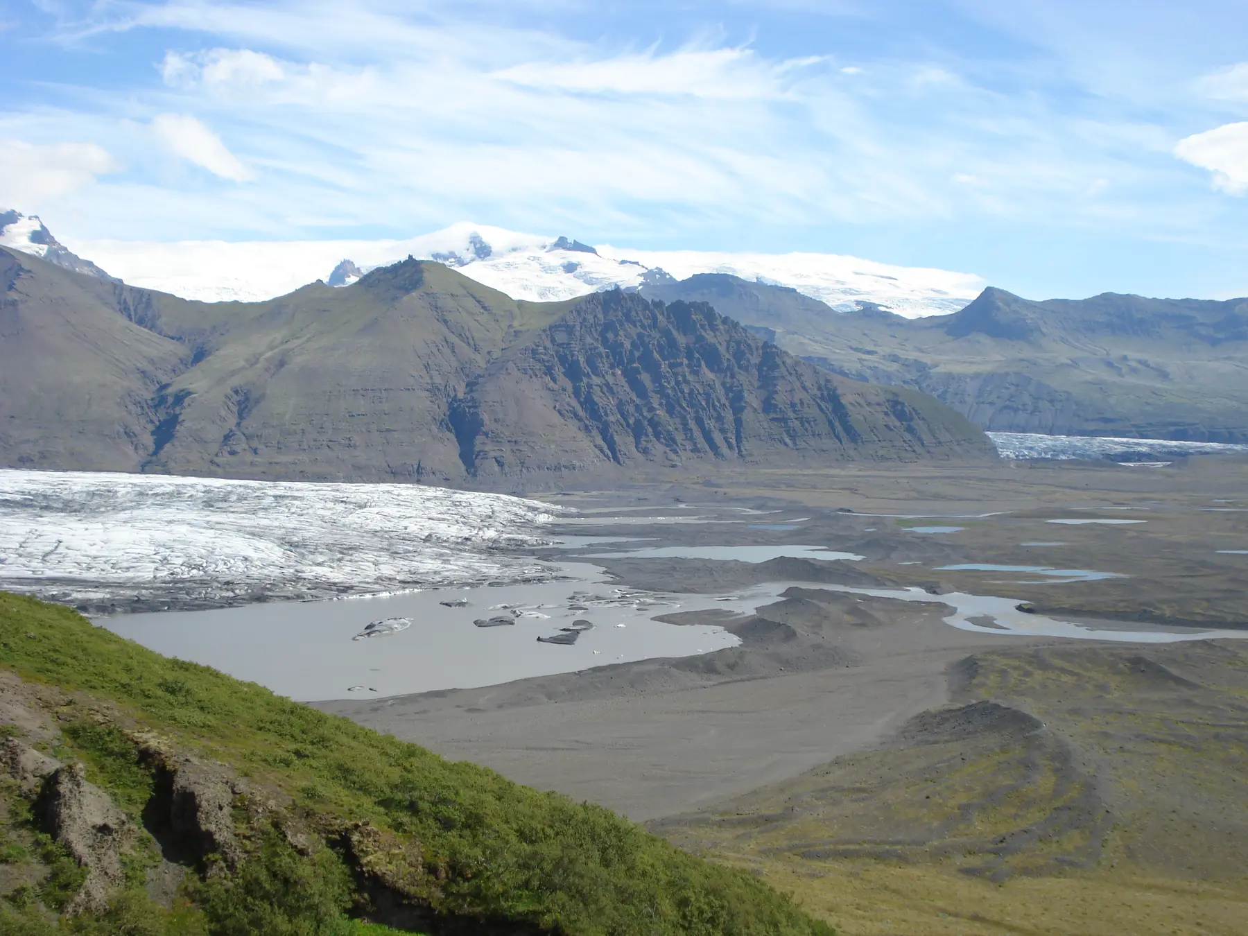
Choose your version of the S1 walk
The S1 Glacier trail is the direct marked walk from Skaftafellsstofa towards Skaftafellsjökull. It is a visitor trail on land, not a route onto glacier ice.
The national park lists the complete circuit as 4.1 kilometres, with an estimated time of 1 to 1.5 hours, 80 metres of ascent and an easy grade. Those figures describe the full S1 route. They do not promise a particular surface, walking time or opening status on the day you visit. [1]
| Your choice | What to do | Why choose it |
|---|---|---|
| Viewpoint return | Walk to the glacier and lagoon viewpoint, then return along the same approach | A gentler option with little height change |
| Full circuit | Continue around the signed return branch across the moraine landscape | More of the interpretation and terrain shaped by the glacier |
The Icelandic version of the official route page identifies the gentler option: turn back from the viewpoint just before interpretation stop 10. It describes that approach as fairly level and with little height change. Use current signs to identify the actual turn, since this guide does not draw a route line. [2]
Skaftafell
On the map
Explore the locations using the links below.
OpenFreeMap · © OpenMapTiles · © OpenStreetMap
Visitor area marker only. This is not a trail line, parking entrance, viewpoint or glacier access point. Follow current park signs and local directions.
Location sources
Start beside Skaftafellsstofa
The park places the S1 start east of Skaftafellsstofa, the visitor centre. Its English route page says the path begins next to the building and is well marked. About half is paved, while the rest uses a generally comfortable gravel surface. [1]
Start by reading the current trail board and any local notice. The park page is a route description, not a live statement that every section is open or free of ice. Rangers and visitor centre staff provide information about trails and the nearby area. [4]
If you are comparing several Skaftafell walks, use our Skaftafell trail comparison. It separates the low S1 route from the longer and steeper options before you commit to a direction.
Read the landscape on the way
S1 is part of the Melting Glaciers interpretation project. Numbered markers point out dikes, moraines, kettle holes, trimlines and stages of vegetation. They turn the walk into a record of how ice has shaped the ground and how plants return after retreat. [1]
Look beyond the glacier itself. Old river channels and ridges in the foreground are part of the story. The viewpoint return keeps the outing simple, while the full circuit crosses more of this exposed landscape.
Do not use the historical hero photograph as a visual guide to the present ice edge or lagoon. It was made in July 2008. The place has continued to change, which is precisely why the interpretation along S1 matters.
Stop at the visitor trail boundary
The park says the trail finishes close to Skaftafellsjökull and provides a good view. It also directs people who move closer to follow the warning sign at the end. Treat that sign and every barrier as the boundary of your visitor walk. [1]
This guide covers the marked land trail only. Loose ground, water and ice beyond the visitor area are not an extension of S1. If your plan is a guided ice activity, use the exact glacier, meeting point and equipment instructions in the booking.
For a first guided activity, read our glacier walk planning guide. For the wider destination, our Skaftafell guide helps you decide whether S1, Svartifoss or another priority fits your day.
Check conditions before walking
- Read current park notices. Look for local signs and ask at the visitor centre when you arrive.
- Check weather and roads together. Use the weather office, Umferðin and Safetravel before leaving your accommodation.
- Dress for the return. Bring warm layers, protection from wind and rain, water and footwear with grip.
- Keep time in reserve. The park estimate does not include every pause, a slower pace or a conversation with a ranger.
- Keep the plan flexible. If the surface or weather does not suit your group, choose another activity rather than forcing the walk.
You can review the same official planning links on our Travel conditions page. It is a planning aid, not an emergency service. [5] [6] [7]
Common questions
Does S1 go onto Skaftafellsjökull?
No. S1 is a marked visitor trail on land that leads to a view of the glacier and lagoon. Stop at the visitor trail boundary and follow the warning sign.
How long is the S1 route?
The national park lists the full circuit as 4.1 kilometres and estimates 1 to 1.5 hours. Add time for interpretation, photographs and the pace of your group.
Can I avoid the full circuit?
Yes. The official Icelandic route page describes a gentler option to the viewpoint just before interpretation stop 10, returning the same way.
Where does the walk begin?
The park places the start east of Skaftafellsstofa and says the marked trail begins next to the visitor centre. Check the current trail board before setting out.
Sources & useful links
Checked 8 October 2026. Trail access, weather and operator details can change.
- Vatnajökull National Park: S1 Glacier trail ↗
- Vatnajökull National Park: Icelandic S1 route detail ↗
- Vatnajökull National Park: Skaftafell ↗
- Vatnajökull National Park: Skaftafellsstofa Visitor Centre ↗
- Safetravel: current travel conditions ↗
- Icelandic Road and Coastal Administration: road information ↗
- Icelandic Meteorological Office: forecasts and warnings ↗