


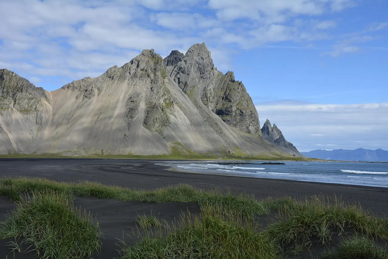
Choose the outing, not just the view
Stokksnes is the peninsula near Höfn; Vestrahorn is the mountain rising above its dark shore. Visit South Iceland describes black sand, a rocky coastline and a mountain made mainly of gabbro. You can appreciate that landscape without making a mountain ascent part of the visit. [1]
For a short stop, make the coastal view your main purpose. Add the replica village if it interests you and you have time. Choose a longer marked walk deliberately, with suitable clothing, daylight and a return plan, rather than letting a photograph turn into an unplanned hike.
The map below is an area marker from the regional tourism board. It is not a parking pin, walking route or mountain access point. Use the operator’s directions and signs for the final approach.
Southeast Iceland
On the map
Explore the locations using the links below.
OpenFreeMap · © OpenMapTiles · © OpenStreetMap
Area marker only. It does not identify parking, a walking route or mountain access.
Location sources
Resolve admission before planning a return visit
The operator directs visitors to Viking Cafe for admission during opening hours and to the outside ticket kiosk when the café is closed. Its visitor questions describe a ticket as valid for one entry, with repeat entry to be discussed with staff. Do not assume a morning ticket automatically permits an evening return. [2]
There is a price inconsistency in the official material checked on 31 October 2026: the website footer and its visitor questions show different admission amounts. Rather than choosing one as confirmed, check the amount and terms directly with the operator before paying. A café purchase should not be treated as an admission ticket. [2]
The operator describes the final 4 km of the approach as gravel and notes that heavy winter snow changes vehicle requirements. That is general access information, not a current road clearance or a guarantee for your rental car. Check the journey on Umferðin, confirm the local approach and follow your rental terms. [3] [7]
Separate a scenic stop from a full walking route
The operator’s area map lists a yellow route of 5.5 km through the beach and village area, a red route of 5.1 km around Kirkjusandur and Drápsbjörg, and a blue route of 7.4 km. It warns that the red route is slippery when wet and says the blue route requires hiking experience and suitable footwear. These are the operator’s published route lengths, not distances from every parking space. [3]
A full circuit is therefore a different commitment from looking at the mountain. Ask for current path advice and the area map before choosing one. This guide does not provide turn by turn directions or establish that any route is presently open.
The village is a film set, not an excavated settlement
The operator identifies the village as a replica built in 2009 for a film project. Its village page says entry is included in Vestrahorn admission. Visit it for the constructed setting and details, without mistaking the buildings for surviving Viking homes. [4]
Leave room for the day you actually get
Our planning suggestion is to decide on the detour while you still have an alternative in Höfn. If the mountain view is your main reason for going and visibility is poor, ask whether you would still enjoy the shore or village. If not, keep that time for town or the next day.
Do not make a particular reflection, sunset or photograph a deadline. Leave space for the approach, admission, changing clothes and the onward drive. Keep to signed visitor areas and avoid stepping onto vegetation for a camera angle.
Safetravel advises matching an outing to everyone in the group and changing or cancelling plans when bad weather makes it unsuitable. Read the official forecast and warnings before leaving. A paid ticket does not make an exposed coastal walk appropriate in all conditions. [5] [6]
Choose a Höfn town stop as an alternative.
Protect your wider winter journey from Vík to Höfn.
Find dated conditions snapshots and official planning links.
Common questions
Do I have to climb Vestrahorn to enjoy Stokksnes?
No. A coastal view and a mountain outing are different objectives. This guide does not describe a summit route.
Is the Viking village an archaeological site?
It is a replica film set. The operator dates its construction to 2009.
Can I leave and return with the same ticket?
Do not assume so. The operator describes one entry per ticket and asks visitors to discuss repeat entry with café staff.
Sources & useful links
Checked 31 October 2026. Trail access, weather and operator details can change.
- Visit South Iceland: Vestrahorn and location ↗
- Vestrahorn operator: admission and visitor questions ↗
- Vestrahorn operator: area map and walking paths ↗
- Vestrahorn operator: replica Viking village ↗
- Safetravel: preparing for outdoor travel ↗
- Icelandic Meteorological Office: forecasts and warnings ↗
- Icelandic Road and Coastal Administration: road information ↗