


Start with what is permitted today
Plan Reynisfjara as a coastal viewing stop, with the shoreline optional only if current official instructions permit access. A successful visit does not require standing beside the basalt columns, entering the cave or walking across the sand. Decide before setting out that a restricted view, or no visit at all, is an acceptable outcome.
Safetravel says stormy weather and high waves restrict access to the viewpoint, despite the sneaker wave alert not being at red level. Follow the current original notice and local closures. This is a dated check, not a prediction for your arrival. [1]
That distinction matters: the warning colour is not the only instruction. Read the whole notice and the signs on site. A parking area being available does not establish that the beach, cave or a particular path is accessible.
In a separate announcement dated 24 February 2026, the Icelandic Tourist Board described erosion beneath the viewing platform and safety signs, with visits limited to the upper beach ridge at that time. Use that report to understand why older images can mislead, not as proof of the infrastructure’s condition now. [2]
Reynisfjara near Vík
On the map
Explore the locations using the links below.
OpenFreeMap · © OpenMapTiles · © OpenStreetMap
Area marker only, not a safe standing position or a walking route. Follow current local signs for permitted access and parking.
Location sources
Separate the beach, mountain and village
Reynisfjara lies between Dyrhólaey and Reynisfjall. The latter is the mountain beside the beach; Reynisdrangar are the offshore rock pillars. The regional tourism page also identifies Hálsanefshellir, the cave by the basalt formations. Knowing the names helps you interpret a destination listing without assuming that every named feature can be reached. [3] [4]
Vík village is a separate stop. If arranging transport, specify Reynisfjara rather than simply asking for the black beach near Vík. If joining an organised outing, ask where the group will stop and how a restriction changes the plan. Do not treat transport to a destination as a promise of access to its shore.
Our map uses the regional tourism board’s destination coordinate. It identifies the area only. It is not a parking entrance, an approved standing position or a route to the cave.
Make these checks before leaving the car
- Read the local access instructions. Look for closures and directions to the permitted viewing area before following other visitors.
- Check the parking terms. Confirm the actual location, vehicle category, payment method and permitted stay on the signs where you park.
- Agree a simple plan. Decide who is supervising children and where your group will regroup. Keep the outing within the current visitor boundaries.
- Prepare for the return. Put on suitable layers and weather protection before setting off. Leave time for changing wet clothing before driving onwards.
Parka’s general guidance asks drivers to choose the correct vehicle and parking location. If using it, match the location to the sign and use the registration number of the car you are actually driving. Keep your payment confirmation. [8]
We have not verified a current destination specific parking tariff or opening schedule. Read those terms directly rather than relying on a price repeated in an older guide. Likewise, check facilities before making this your only planned meal or toilet stop.
Let the view be enough
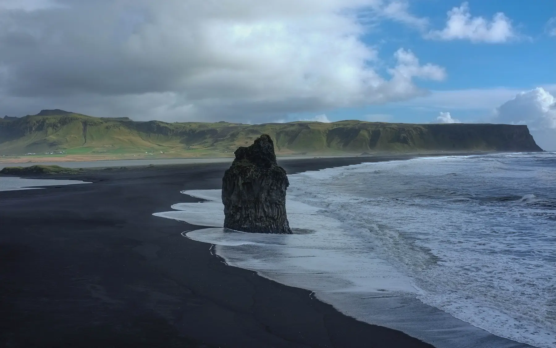
The appeal is the contrast: dark shore, pale surf and the scale of the surrounding rock. You can give that landscape your attention without trying to reproduce a particular photograph. The image above was taken in 2016 from the Dyrhólaey side; it illustrates the coast, not a route across it.
Safetravel warns that unusually large waves can arrive among smaller ones without a predictable interval. It also warns of falling rocks. Keep well away from the water, keep watching the sea and keep children with an adult. A few quiet minutes are not evidence that conditions have become safe. [1]
Visit Iceland advises against swimming or surfing here and against approaching the cliffs because of rockfall. Do not move into a hazardous position to help another person. For an emergency, call 112. [5]
For photographs, choose a permitted position first and compose from there. A tighter frame or a more distant view is preferable to edging past a barrier. If the view you hoped for is unavailable, leave it for another trip rather than looking for an informal way around the restriction.
Keep the rest of the day flexible
Before driving, check weather warnings and road conditions for the journey, not just the destination. Our Travel conditions page provides dated snapshots and official links; it does not confirm beach access. [6] [7]
If your day already includes Sólheimajökull, protect the time needed for that visit and your onward drive. Do not turn a coastal stop into an unplanned long walk simply because there is still daylight.
Dyrhólaey offers a different headland outing, not an automatic fallback during dangerous weather. Check its own access information independently. When exposed outdoor stops are unsuitable, consider a shorter day with time in Vík instead, checking town facilities before you go.
A useful test is whether your itinerary still works without Reynisfjara. If dropping it leaves you with a comfortable drive, a meal and your planned overnight stop, you have left enough flexibility.
Common questions
Does a non red warning mean I can walk on the beach?
No. The access notice checked for this guide restricts visits to the viewpoint without a red alert. Follow the full current notice and local closures.
Can I plan to enter Hálsanefshellir?
Do not build your visit around cave entry. The current viewpoint restriction does not permit that outing; check official instructions again before travelling.
Is the photograph a current access guide?
No. It is a historical 2016 coastal view from the Dyrhólaey side. Neither the photograph nor the area map identifies a safe place to stand today.
Is a short visit worthwhile?
A permitted viewpoint visit can be the whole outing. Choose it for the landscape rather than a list of features you must reach, and be ready to leave if conditions are unsuitable.
Sources & useful links
Checked 18 October 2026. Trail access, weather and operator details can change.
- Safetravel: current Black Beach safety and access notice ↗
- Icelandic Tourist Board: erosion announcement dated 24 February 2026 ↗
- Visit South Iceland: Reynisfjara, Reynisfjall and Reynisdrangar ↗
- Katla UNESCO Global Geopark: Reynisfjara landscape and precautions ↗
- Visit Iceland: coastal hazards and visitor precautions ↗
- Icelandic Meteorological Office: forecasts and warnings ↗
- Icelandic Road and Coastal Administration: road conditions ↗
- Parka: parking location and payment guidance ↗