


Plan a walk above the canyon
Fjaðrárgljúfur makes sense as a deliberate walking stop on a South Coast journey, rather than a photograph squeezed between driving deadlines. The useful first decision is to stay with the visitor path above the gorge. You do not need to reach the river to appreciate the folds of rock and the water below.
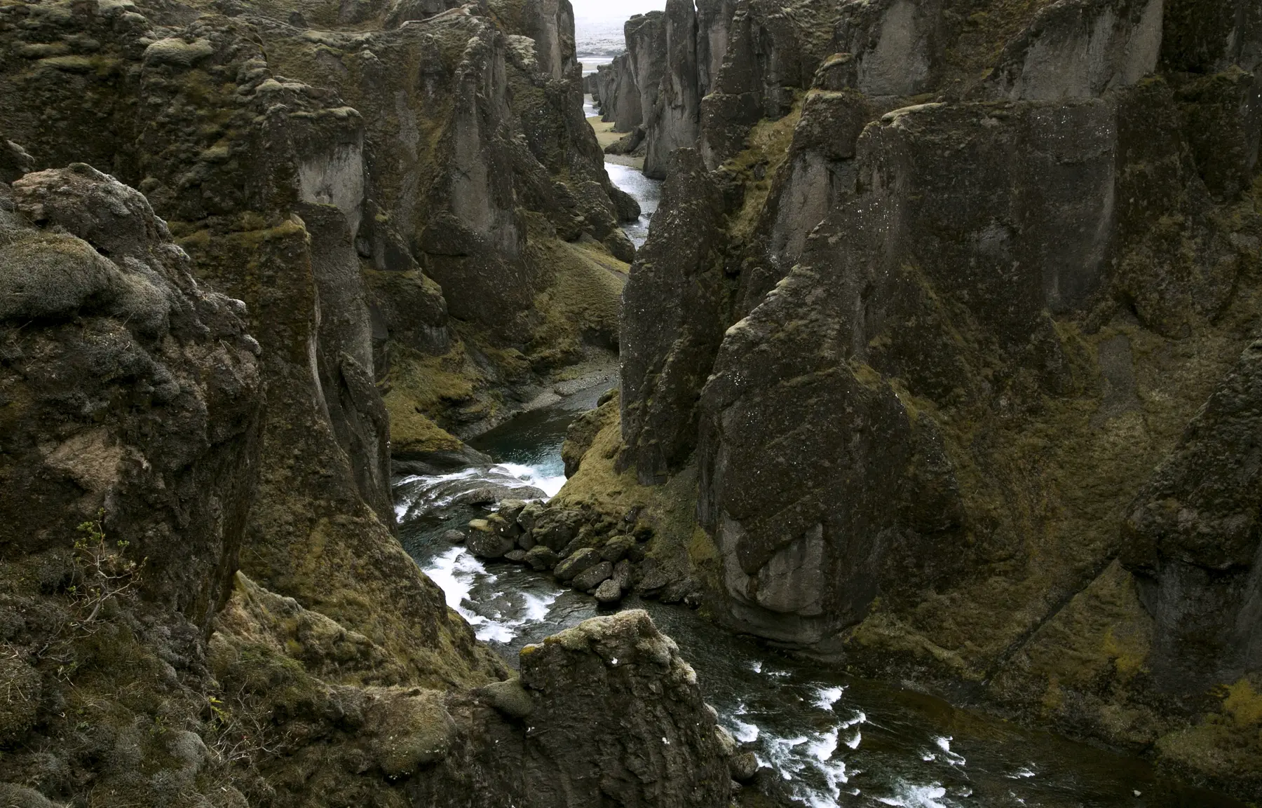
The canyon lies west of Kirkjubæjarklaustur, off the Ring Road. Its steep walls are largely palagonite, with the Fjaðrá river running through them. The regional tourism account explains how water from a lake formed during glacial retreat helped cut the gorge. [2] [7]
Our map uses the official tourism destination coordinate as an area marker. It is not a parking entrance, a trail line or a recommended position near the edge.
Fjaðrárgljúfur near Kirkjubæjarklaustur
On the map
Explore the locations using the links below.
OpenFreeMap · © OpenMapTiles · © OpenStreetMap
Destination area marker only. Follow current signs for permitted parking and paths. This is not a trailhead or a suggested position near the edge.
Location sources
Road 206 and F206 are different approach decisions
The Nature Conservation Agency identifies the main visitor parking south of the canyon mouth on Holtsvegur, Road 206. A path with viewing platforms follows the gorge towards a northern parking area on its eastern side. That second approach uses Lakavegur, F206, and is available only while the road is open. Toilets and a resting area are listed at the main parking area. [1]
Choose your arrival point before starting navigation. A search result for the same canyon can conceal a different road approach. Check Umferðin and your vehicle’s rental restrictions rather than assuming that a pin closer to the far end saves time. This guide does not verify that either approach is passable today. [6]
Some tourism descriptions use F206 for the destination generally and describe access throughout the year. Use the conservation agency’s more specific distinction when planning, and current road information when travelling. A general destination description is not a road condition report. [1] [2] [7]
Read the payment terms before walking away
The agency links visitors to Parka for the landowner’s service charge. Parka’s current page says payment is valid until midnight, with online payment allowed up to 24 hours after leaving. Vehicle categories determine the charge, and unpaid parking can incur an additional fee. Check the amount for your vehicle directly rather than relying on an old quoted price. [3]
Enter the actual registration number, confirm the correct destination and keep the receipt. For a rental vehicle, use the number on the car rather than a reservation reference. Sorting this out before the walk leaves one less thing to remember during the drive onwards.
Parka lists the car park as open around the clock but explicitly prohibits overnight stays. Those parking hours are not a guarantee of suitable walking conditions or permission to camp. [3]
Choose a turning point, not a photo to reproduce
The agency says the canyon floor has no marked hiking routes and is not intended for general pedestrian traffic. Keep this outing on the established rim path and viewing platforms. [1]
Decide how long you can give the whole stop before leaving the car. Work backwards from the next fixed commitment, reserving time for the return walk, photographs, clothing changes and getting ready to drive. The farthest viewpoint need not be your goal.
This guide does not assign a fixed walking duration or distance: the canyon’s geological length is not the length of your chosen return route. Use the local signs to judge the available path, and shorten the outing if your group is moving more slowly than expected. A partial visit is better than rushing the return.
Take photographs from permitted positions. Do not step beyond a barrier, stand on a narrow projection or copy a person’s position in an older image. The photograph here dates from 2016 and documents the landscape, not an approved place to stand today.
Weather and fragile ground change the plan
The conservation agency asks visitors to stay on marked paths, especially because rain and thaw make the vegetation vulnerable to damage. If a section is closed, leave it closed rather than making a parallel track around it. [1]
For a short walk, Safetravel recommends carrying a phone, hat, gloves and protection from rain and wind. Pack for the return as well as the outward leg. Download any map you need before losing connectivity and keep enough phone battery for communication. [4]
Read the weather forecast and warnings before leaving your accommodation and reassess before the detour. An exposed viewpoint is optional when conditions are poor. In winter, do not assume snow or ice can be dealt with simply by walking more carefully. Respect local restrictions and turn back if footing or visibility does not suit your group. [5]
Our Travel conditions page provides dated snapshots and official links. It is not an emergency service or confirmation that the canyon path is open.
Give the canyon time by removing another stop
Travelling east from Vík? Decide whether this is your main walk before adding a long hike at Skaftafell later that day. Two walking destinations can both fit on a map while competing for the same daylight and energy.
Use our Vík to Höfn two day itinerary as a framework, then substitute rather than endlessly add. If the canyon is the priority, keep the later stop lighter. If a Skaftafell trail is the priority, leave this detour optional.
A useful final check is simple: if the road or path is unsuitable, can you drop the canyon without losing your accommodation plan? A flexible answer makes the rest of the journey easier.
Common questions
Is the canyon floor part of this walk?
No. This guide plans a rim visit, not a riverbed hike. Follow the current official access guidance and local signs.
Does a parking payment cover a full 24 hours?
Parka currently says the fee is valid until midnight each day. Read the current payment terms for your date and vehicle.
Can I stay overnight in the car park?
No. The payment page explicitly prohibits overnight stays, even though it lists the parking area as open around the clock.
Is the map pin a trailhead?
No. It is an official destination area coordinate for orientation. Use signs and the appropriate road approach to find permitted parking.
Sources & useful links
Checked 17 October 2026. Trail access, weather and operator details can change.
- Nature Conservation Agency: current canyon access and conservation guidance ↗
- Visit South Iceland: canyon landscape and destination coordinates ↗
- Parka: Fjaðrárgljúfur parking terms and vehicle categories ↗
- Safetravel: preparation for short walks and longer hikes ↗
- Icelandic Meteorological Office: forecasts and warnings ↗
- Icelandic Road and Coastal Administration: road information ↗
- Visit Klaustur: local destination context ↗